 Photo: John Fowler from Placitas, NM, USA, CC BY 2.0
- Best months
- Any month, storms in winter
- Getting there
- Highway 101, a few miles south of Yachats
- Bring
- Grippy shoes, a rain jacket and a tide table
South of the small town of Yachats, the coast road climbs around the flank of Cape Perpetua, a high headland covered in dense forest of Sitka spruce and hemlock, with a jagged shore of black basalt at its foot. The cape is protected as a scenic area within the national forest, and it packs an extraordinary range of sights into a small area: a viewpoint high above the sea, an ancient tree, and a shoreline where the ocean plays tricks with the rock.
The view from the stone shelter
A narrow road winds up from the highway to a viewpoint near the summit of the cape, roughly 800 feet above the sea. It is often described as the highest point on the Oregon coast that you can drive to, and on a clear day the view runs for many miles north and south along the coast and far out to sea.
A short trail leads to a small stone shelter on the summit, built in the 1930s by the Civilian Conservation Corps, a Depression-era public works programme that built trails, shelters and roads in parks and forests across the country. The shelter was used as a lookout for enemy ships and aircraft during the Second World War. From it, you look straight down onto the shore and the waves breaking on the rocks.
The cape itself takes its name from the British explorer James Cook, who sighted it in March 1778 on the feast day of Saint Perpetua and named it after her.
Thor's Well
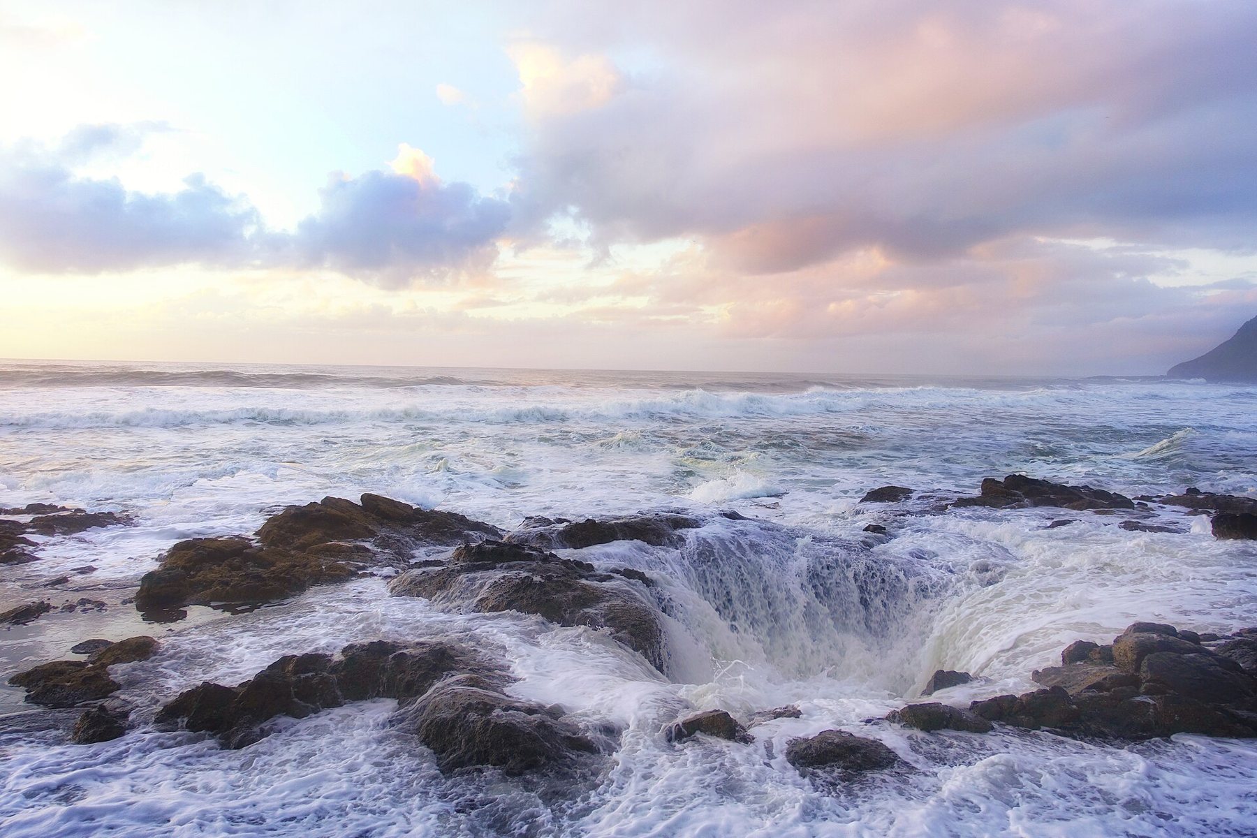
On the rocky shore below the cape lies Thor's Well, a hole in a shelf of basalt that seems to swallow the ocean. As waves wash over the shelf, water pours into the hole from all sides and disappears, then, as the next surge arrives from below, it bursts upward in a fountain of spray. The hole is probably a collapsed sea cave connected to the ocean underneath, so that the sea both drains into it and pushes up through it.
The well is most dramatic around high tide, especially when there is a good swell, and in the hour or so before and after high water it can be mesmerising. It is also deadly. People have been swept into the well and off the rocks around it. Watch from the higher rocks and from the trail, at a safe distance, and never walk out onto the shelf beside the hole, however calm the sea looks at that moment. A single larger wave can cover the whole shelf.
It is also deadly.
Devils Churn and Cooks Chasm
Nearby, Devils Churn is a long, narrow inlet cut into the basalt along a line of weakness in the rock. Waves rush up the narrowing channel and explode against its end, throwing spray high into the air, especially at high tide and in winter storms. A trail leads down from a parking area to viewpoints along the edge.
Cooks Chasm, another narrow cleft in the rock near the base of the cape, includes a spouting horn, where water is forced up through a hole in the roof of a sea cave and blasts out in a jet of spray. Like Thor's Well, it is best near high tide with a swell running.
At low tide, the same shore becomes a place of quiet tide pools, with sea stars, anemones, urchins and other creatures in the basalt hollows. The waters off the cape form one of Oregon's marine reserves, where fishing and the removal of marine life are restricted.
The forest and the Giant Spruce
Inland, the cape is covered in temperate rain forest, and trails wind through it from the visitor centre. One leads up a creek valley to the Giant Spruce, a huge Sitka spruce several centuries old, with a trunk so wide that it takes several people with outstretched arms to circle it. Its roots spread over the forest floor, and the trail passes beneath its branches. The tree is thought to have begun life on a fallen log, a common way for spruce to grow in these forests, and the hollow beneath its roots shows where the nurse log rotted away long ago. The walk to it is a gentle hour or so along a creek through ferns and moss.
Other trails climb to the summit, follow the shore and pass ancient shell middens, mounds of discarded shells left by Native people who gathered food along this coast for thousands of years. These are archaeological sites and must not be disturbed, and the trail signs explain what they reveal about life on this shore.
The Captain Cook trail
From the visitor centre, a short loop trail passes under the highway to the shore, leading to viewpoints over the spouting horn at Cooks Chasm and on to Thor's Well and the tide pools. It is the easiest way to see the shore features, and the paths are well marked. In wet weather, the rocks and boardwalks are slick, and the spray from the chasm can soak you on a windy day. Keep to the paths, read the warning signs and pay attention to the tide.
Yachats, the town to the north
The small town of Yachats sits at the mouth of the Yachats River, a few miles north of the cape. Its name is pronounced roughly YAH-hots and comes from the language of the Native people who lived along this coast. The town has a rocky shoreline with tide pools and spouting holes of its own, a path along the waterfront and a relaxed, artistic feel. It makes a good base for exploring the cape at different tides over a day or two.
Every year in late winter and early spring, small silvery fish called smelt run into the rivers of this coast to spawn, and the area has long celebrated them. Along the shore, in the right season, you may see people dipping nets in the surf.
Planning around the tide at Perpetua
The visitor centre, near the highway, has exhibits on the cape's geology, ecology and history, and staff who can tell you when high tide will be best for Thor's Well. Check opening hours and the day-use pass requirements before you go. Allow at least half a day to see the viewpoint, the shore and the spruce.
Check a tide table before you set out. For Thor's Well and the Churn, aim for an hour or so before high tide. For tide pools, aim for a low tide. Sunset at Thor's Well is very popular with photographers, so expect company. Then continue south to Heceta Head, or north to Yaquina Head and Cobble Beach.

 Photo: Gary Halvorson, Oregon State Archives, CC BY 4.0