
- Best months
- May to October
- Getting there
- Highway 101 north of Florence
- Bring
- Walking shoes, binoculars and a camera
North of Florence, Highway 101 swings around a headland and crosses a creek on a graceful concrete arch, and suddenly there is a lighthouse in view, white against dark forest, high on a cliff above the sea. This is Heceta Head, one of the most photographed lighthouses on the West Coast, and the cove beneath it, at Devils Elbow, is one of the prettiest beaches on the central Oregon coast.
Heceta Head's light
The Heceta Head lighthouse was first lit in 1894, a short tower set on a ledge high above the water, so that its beam could be seen far out to sea. Its light is often described as the strongest on the Oregon coast, visible many miles offshore, and it is still an active aid to navigation. The lighthouse is part of a state scenic viewpoint, and tours of the tower are offered at certain times of year; check before you go.
The headland takes its name from Bruno de Heceta, a Spanish naval officer who explored this coast in the 1770s.
The trail up
From the parking area at Devils Elbow, a trail of about half a mile climbs through the forest to the lighthouse, passing the large white keeper's house on the way. The house is a historic building and is not open to casual visitors, so admire it from the trail. The climb is steady but not long, and the views from the lighthouse over the cove, the bridge and the coast to the south are wonderful. Benches along the way give a chance to rest and look down through the trees to the water. In early summer the trail edges are bright with salmonberry and foxgloves.
The trail continues beyond the lighthouse as part of the Oregon Coast Trail, climbing through the forest over the headland with occasional viewpoints. It is a good longer walk if you have time.
Devils Elbow
The cove below the lighthouse, Devils Elbow, is a small, sheltered beach where Cape Creek flows into the sea. There are picnic tables, restrooms and a short walk to the sand. At low tide, the rocks at the edges of the cove reveal tide pools, and the beach is a pleasant place to sit and watch the waves and the birds.
The cove is small and steep-sided, and waves can reach the base of the cliffs at high tide. Keep an eye on the water and be careful on wet rocks. Driftwood logs pile up at the top of the beach after storms; they are heavy and can shift, so do not let children climb on them when waves are reaching the logs.
McCullough's arch over Cape Creek
The highway crosses Cape Creek on a concrete arch bridge, built in the early 1930s. It is one of a series of bridges on the coast highway designed by the state's bridge engineer at the time, Conde McCullough, who combined engineering efficiency with elegant forms. His bridges at Newport, Florence, Coos Bay and elsewhere are among the landmarks of the coast, and the Cape Creek bridge, with its arches marching across the creek valley, frames the lighthouse view perfectly from the beach below.
Seabirds and sea lions
The rocks off Heceta Head are an important nesting site for seabirds, especially Brandt's cormorants and common murres, which crowd the ledges in spring and summer. Pigeon guillemots and black oystercatchers are common along the shore.
South of the headland, the cliffs drop to the sea at a large natural sea cave where Steller sea lions gather, and the area around it is one of the few places on the mainland where these huge animals breed. From roadside viewpoints along the highway, you can often see sea lions on the rocks below, and hear them too. Watch from above; never try to approach them. Their roars carry a long way on a still day.
The keeper's house and the people who lived there
Like other lighthouses on the coast, Heceta Head was once home to keepers and their families, who lived in houses on the headland and tended the light through every storm. The surviving keeper's house is a large Queen Anne style building, and it has gathered its share of ghost stories over the years, as such places do. The families who lived here grew vegetables, kept animals and sent their children to a small school, and supplies came by wagon or boat until the coast highway was built. Exhibits at the lighthouse tell some of their story.
Florence and the Siuslaw
A short drive south, the town of Florence sits at the mouth of the Siuslaw River, with an old town district along the river, another of the coast's arched bridges and access to the northern end of the Oregon Dunes. In spring, the area is known for its rhododendrons, which bloom along roadsides and in gardens in shades of pink and purple. Florence is a good place to stop for supplies before heading into the dunes.
Heceta Head through the year
Late spring and summer bring nesting seabirds and the best chance of calm weather for the walk, though fog is common on summer mornings. Autumn is often clear. In winter, storms make the coast wild and the lighthouse beam stands out on dark afternoons. Parking at Devils Elbow is limited and a day-use fee applies. From here, continue south to Florence and the Oregon Dunes, or north to Cape Perpetua.

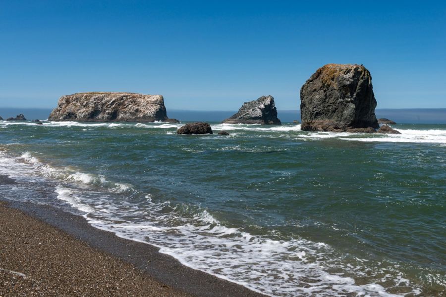 Photo: Gary Halvorson, Oregon State Archives, CC BY 4.0